The Warrnambool Foreshore Framework Plan has been completed, and was adopted by Council at the February 3, 2025 Ordinary Council Meeting.
Read the Warrnambool Foreshore Framework Plan
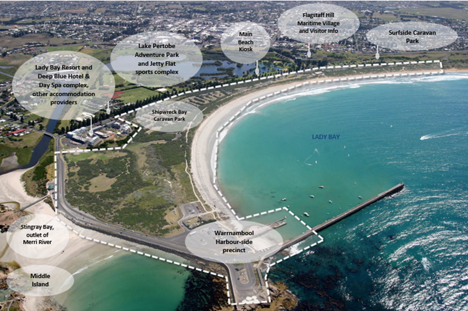
The Foreshore precinct sits to the south of Warrnambool’s Central Business district, bordering the Lady Bay and southern ocean. It sits between the outlet of the Merri River at Stingray Bay to the west, and the Flume access point off Merri Street to the east. It is bordered by Pertobe Road to the north.
The purpose of the Framework Plan is to provide an overarching planning framework for the Warrnambool foreshore area, bringing together previous planning projects and providing an integrated vision for the precinct. The Plan will help inform long term objectives and funding priorities for the Warrnambool Foreshore.
The Framework Plan considers social, economic and environment values of the precinct. It was informed by a multi-stage community and stakeholder consultation, existing conditions analysis, and issues and opportunities assessment. The environmental landscape context were an important influence on the development of the plan.
Council engaged consultancy firm Realm Studios to help prepare the Warrnambool Foreshore Framework Plan.
For further information, please contact Amy Cumming, Open Space Planner, on (03) 5559 4421 or acumming@warrnambool.vic.gov.au